15th Century Map of the Arabic World


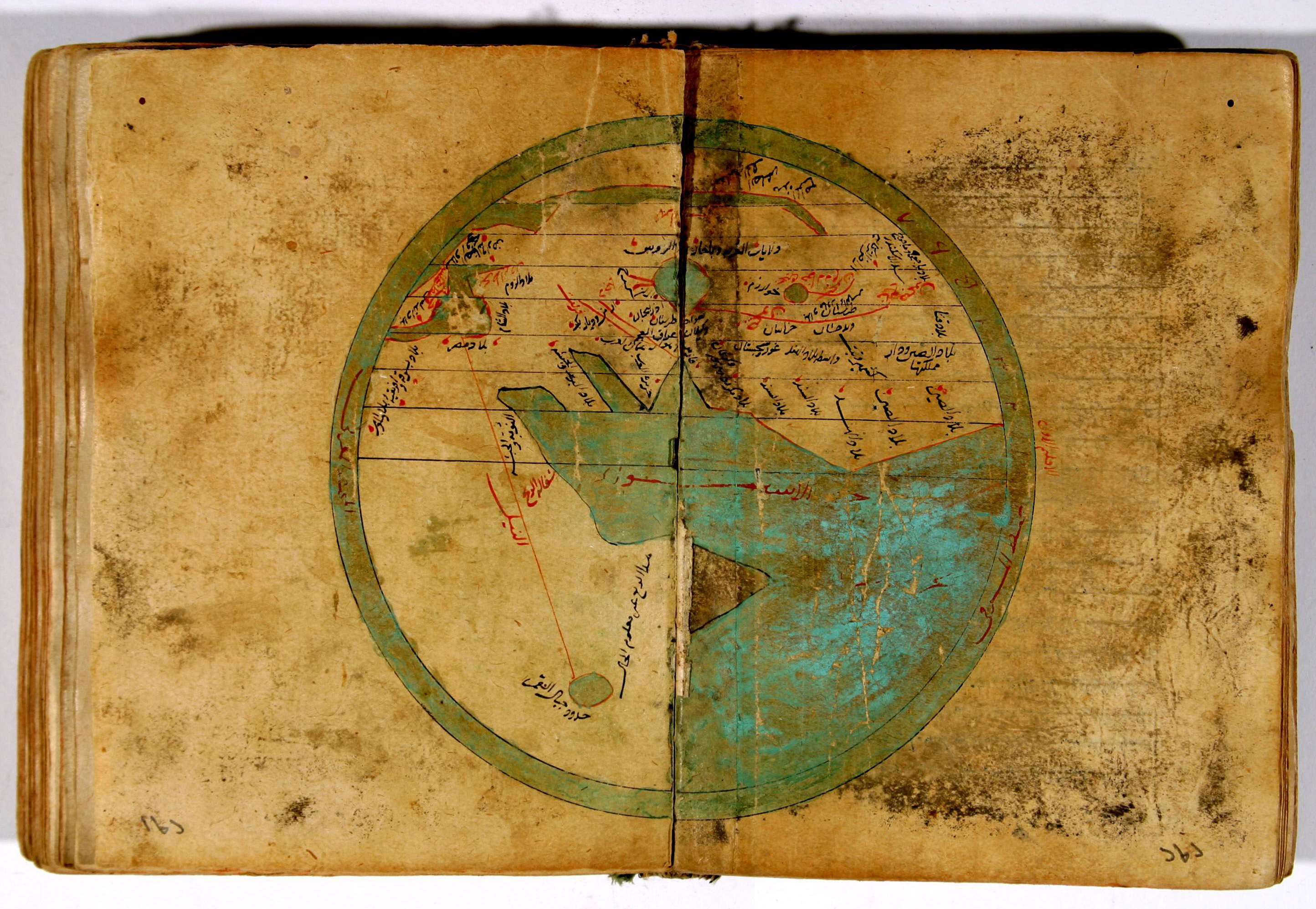
(Click the map for a larger version)

A map of the world from Nazam al-Din al-Hussein bin Muhammad al-Nishapuri's Sharh al-Tadhkarah, an astronomical commentary originating from Anatolia or Iran i the early fifteenth century.

In keeping with Arab tradition, the map in the manuscript appears with north at the bottom (left). It is centered on the Persian Gulf, with the Horn of Africa in the middle of the lower half. Immediately recognizable is the Mediterranean at the west-north-west edge with "Bilad al Sham" (Syria, Lebanon, and Palestine) at the eastern end, just below Anatolia which is "Bilad Al Rum" (the land of Rome, i.e. Byzantium), and "Bilad Masr" as Egypt. "Bilad Andalus" is the Iberian peninsula at the western end. "Al Nil" is the straight red line between the lake southeast of the Horn and Egypt. The bodies of land with their southern points descending into the Indian Ocean are from right to left: "Bilad al Hind (India), "The Island of the Arabs" (Arabian Peninsula), and mysteriously "Bilad al Barbar wal Habasha" (The land of the Barbarians and Abysinnia) is the Sinia Peninsula.

The maps appears on pages 291-292 of manuscript [ms520.956.N23sA] from the Jafet Library's Archives and Special Collections at the American University of Beirut.

----------------

al@mashriq

Last modified: Tue Oct 13 15:35:15 2015