
|
|||
|
|||
 Bint Jbeil, March 4, 2007 |
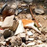
On Sunday March 4 we drove south to Bint Jbeil and Maroun el Ras following the border north to Marjayoun. From there we tracked back to Nabatiyeh following the valley beneath Beaufort Castle and on to Zahrani, Sidon and Beirut. The images show some of the destruction in Bint Jbeil and Maroun el Ras. There are also images of the electronic fence along the border, some pictures from Marjayoun and Beaufort Castle ('alaat sh'if) seen from the east. Most of the pictures are geotagged. (GPS coordinates are embedded in the image.) The kml-file under each image contains the location information for the picture. The track with links to pictures is here: 20070304-track.kml To add to Google Earth as network link, right-click the link above, "copy to clipboard" and then add to the "Network link" diaglog box in Google Earth under the "Add" menu. Thumbnails of the pictures are here: 20070304-images.html All images © Børre Ludvigsen, 2007 |
||
 Last modified: Sat Mar 10 13:12:54 2007
|
|||