
|
[Prev] [Main] [Next] |
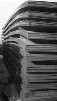 Sheet Steel Stock Pile |
found almost anywhere in the world. There were only a few tiny settlements along the desert route. A tree was a rarity anywhere from the Persian Gulf to the frontier of Lebanon. The route crosses heavy sand dune country only on its first hundred miles on the east end. West thereof for 750 miles it crosses absolutely barren desert land to the Jordan frontier. The only noticeable surface features are occasional dry wadis where surface water flows or stands for a few days, and sometimes only for hours, after rain showers. Average rainfall is only three inches per year. Normally no rain falls from April to November inclusive. The surface of this 750-mile stretch is either level or gently sloping and is about evenly divided between smooth gravel plains, disintegrated limestone overlaying hard limestone strata, and level country with two to six inches of topsoil covering limestone hard enough to require blasting for removal. The line reaches its highest elevation, 2975 feet above sea level, just before it leaves Saudi Arabia. The 80-mile route across Jordan was regarded as the toughest section of the entire route because the surface is completely covered with hard basalt and volcanic lava, disintegrated in chunks ranging from a few pounds to as much as several tons. It is practically an insurmountable obstacle for pedestrians. The stretch of slightly more than 100 miles across Syria resembles West Texas and New Mexico in some respects. Although the surface is covered with some broken limestone, 40 or 50 miles are across land cultivated for wheat. Approaching the Syria-Lebanon frontier the line descends a steep escarpment into the south end of what is called the Bekaa Valley, which runs northward between two mountain ranges, the Lebanon and the |
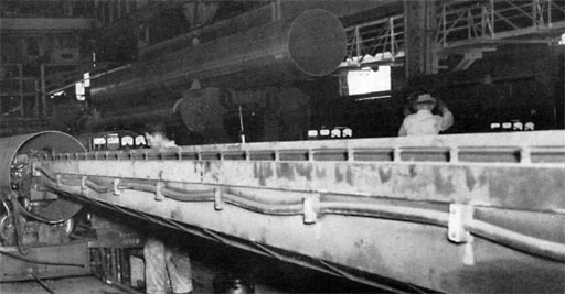 Automatic twin-arc machine welding the inside of a 31-inch joint |
|
| [Prev] [Main] [Next] | |

980402/bl