
| |
|
In Syria, at Antioch, Damascus, Aleppo and Lattakia, the Seleucids established cities with regular patterns of streets organized on a grid plan. The houses and buildings of the cities were arranged in rectangular blocks. A similar design for town-planning was later adopted by the Romans. We knew that the Romans established a colony at Beirut in the late first century BC, but we did not know whether they designed a regular street plan for the city or whether it had been designed by Hellenistic rulers.
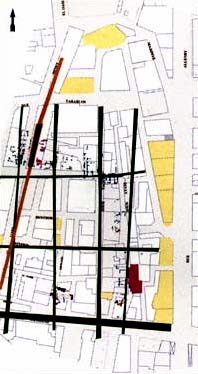
The AUB - Leverhulme Excavations during 1994 in the Souk area have uncovered evidence not only of a grid of Roman buildlngs and streets, but also of Hellenistic buildings. Now for the first time we can see how this part of Beirut developed, and what parts of the ancient plan survived into moclem times. Houses with rich mosaic floors stood beside workshops in rectangular blocks divided by narrow straight streets and alleys. One of the modern streets, Souk Tawile, follows the lines of an ancient street to this very date.
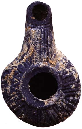
Now that we have established the Hellenistic origin of the Souk area, we will be looking carefully at the
objects, pottery and coins from the many layers of occupation belonging to the Hellenistic period. This
information will allow us to say when this plan was created. Was it created by the Seleucid kings, who
ruled Lebanon from the early second to the first century BC, or was it designed by the Ptolemies of Egypt,
who ruled Lebanon before the Seleucids? Only detailed scientific excavations and analyses of the finds can
provide the answer to this fundamental question about Beirut's past.
| |
 al@mashriq 960118/960118 |
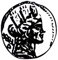
 The Hellenistic kings (third to first century BC) were fond of establishing new cities or redeveloping existing
ones. Often they renamed cities after themselves or members of their family. Beirut was renamed Laodicea
in Canaan by the Hellenistic Seleucid kings, in honor of a Seleucid Queen named Laodice.
The Hellenistic kings (third to first century BC) were fond of establishing new cities or redeveloping existing
ones. Often they renamed cities after themselves or members of their family. Beirut was renamed Laodicea
in Canaan by the Hellenistic Seleucid kings, in honor of a Seleucid Queen named Laodice.
 The Roman street plan of Beirut has been traced by studying the positions of the buildings and ancient
roads, as well as modern roads which follow the line of ancient streets and preserve part of the old plan. Now
that large areas of the city have been exposed and opened for archaeological exploration, we can find the
ancient roads and study the ancient street plan in detail. Excavation can also help us to find out when this
plan was devised.
The Roman street plan of Beirut has been traced by studying the positions of the buildings and ancient
roads, as well as modern roads which follow the line of ancient streets and preserve part of the old plan. Now
that large areas of the city have been exposed and opened for archaeological exploration, we can find the
ancient roads and study the ancient street plan in detail. Excavation can also help us to find out when this
plan was devised.
 The most important discovery by the AUB- Leverhulme team in this respect concerns the Hellenistic layers
beneath the Roman buildings. We have discovered that the earlier Hellenistic buildings follow the same
street plan as the later Roman ones, and therefore the street plan of the Souk area is Hellenistic, not Roman.
The most important discovery by the AUB- Leverhulme team in this respect concerns the Hellenistic layers
beneath the Roman buildings. We have discovered that the earlier Hellenistic buildings follow the same
street plan as the later Roman ones, and therefore the street plan of the Souk area is Hellenistic, not Roman.