
|
[Prev] [Main] [Next] |
|
- 15 - A few Arab soldiers are stationed at the Army airfield. The Duwaid landing strip where the party pitched camp is about 10 kilometers to the north, in the bottom of the Wadi Khurr. This duplication on names is confusing, and is further confounded by the fact that neither of the Duvaid air strips Is at Duwaid, and by the custom of some of the airplane pilots to refer to the useable Duvaid air strip as Lauga. In the afternoon it was decided to proceed as far west as practicable along the "Prospectus" or "A" route. After leaving the Wadi Khurr, the route passes over intermittent rock plains of the Hajara type, interspersed with grassy patches on which many gazelles were sighted. These little 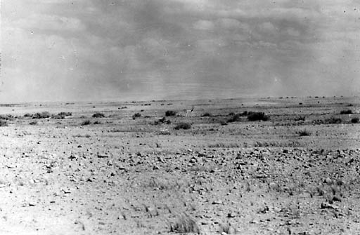
Fig. 21 A Gazelle on the Plains near Wadi Fajj es Salubi animals have a top speed of about 60 or 65 kilometers an hour. All of the terrain passed over was good for road and pipe line construction, though inferior to the flat rock and gravel plains east of Jumaima. There were many grassy patches where the soil was at least thick enough to support vegetation, but the general impression was that the rock was close to the surface where It was not actually exposed. Burying a pipe line in such territory would be very expensive and it is believed that a substantial fraction of the line should therefore be laid above ground. Just what fraction might be buried could only be determined by drilling test holes at frequent intervals, Such an investigation could well be carried out along with the survey. It was possible to drive at thirty to fifty kilometers an hour although hardly any work had been done on the trail, but the ride could hardly be called comfortable, and the war-built synthetic tires suffered. The party would have liked to see the Wadi Ar'ar, but as night driving was inadvisable, turned back just beyond the Wadi Ab al Ghur some forty kilometers short of this, in order to make camp by dark. |
|
|
[Prev] [Main] [Next] |
|

980328/bl