
|
[Prev] [Main] [Next] |
|
- 35 - sula, except for the first 10 miles out of Aqaba where construction would probably be extremely difficult in spite of the fact that a passable road already exists. (The road already occupies the only place where it would be easy to put the pipe line). In general, as the maps indicate, the road follows a plateau north of the rough broken country that apparently characterizes the rest of the peninsula to the south. The impression received by an observer looking out of the airplane window to the south while flying over this road would be that the country was impassable while an observer looking north would see nothing difficult. Just south of Suez on the west side of the Gulf of Suez there are tall cliffs and the road veers somewhat to the north to avoid these. There seems, however, to be a pass through these cliffs to the south and while this was not explored by the reconnaissance flight, it would perhaps furnish an alternative pipe line route if there should be any reason to build a line from the Gulf of Suez to Alexandxia or Cairo without entering the Port of Suez. This flight terminated at 2:30 P.M. Cairo time, May 18 when a landing was made at Payne Field. The start from Dhahran had been at 4:25 A.M. Cairo time. FIRST RECONNAISSANCE FLIGHT TO AQABA, EL ARISH AND GAZA After the flight just described, arrangements were made for a reconnaissance flight to Aqaba, Gaza, and EI Arish on Monday, May 20 in the same airplane. The party, as before, consisted of Wolfe, Johnson, Chandler, and Bramkamp. The flight left Payne Field at 10:00 A.M. and returned to Suez along the road. Several pictures were taken along the road, Fig. 54, being more or less typical. At Suez it was observed that there was a sizeable oil port with tankage. This is indicated in Fig. 55. 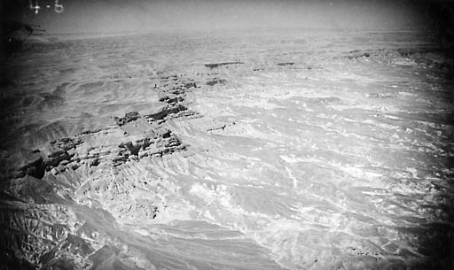
Fig. 52 Sinai Peninsula South of Nakhi |
|
|
[Prev] [Main] [Next] |
|

980329/bl