
|
[Prev] [Main] [Next] |
|
- 8 - Berg and Ovens, the geologists most familiar with the territory to the west were to accompany the party, but they proceeded to Ansab by the regular road, rather than cross country. The distance from Uguba to Ansab, is about 100 kilometers and the first 50 was not bad going for pipe line construction, although definitely more broken than the smooth Jeraiba plains to the south. The second 50 miles, however, across the rough surface of the marine limestone was definitely objectionable. Pipe line construction across this stretch would not be out of the question, but there would be every reason to route the line somewhat farther to the south where the terrain Is smooth and the stones are much less rough and not so destructive to automobile and truck tires. There was a geological camp at Ansab Wells under the charge of M. F. Yakel and at this point Ansab Water Well No. 2 was at that time being drilled. The party viewed an outstanding topographical feature west of Ansab in the afternoon of May 2 - a depression surrounded by cliffs, and said to be thought by the Bedu to be the home of evil spirits. This would easily be avoided by pipe line route. Examination of some of the Miocene fresh water limestone broken from these cliffs showed that it is soft only by comparison to the extremely hard Eocene limestone. As a matter of fact, it would all have to be blasted if the pipe line were to be trenched. 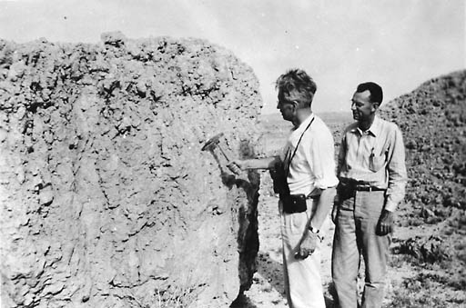
Fig. 8 "Soft" Miocene Limestone On the third of May, the party now augmented by Yakel, as well as Berg and. Owens, visted Ansab Wells (Fig. 9). These are typical ancient Arabian wells like that at Uguba, perhaps thousands of years old and almost certainly dating before the time of Islam. The ground around the wells has, over the centuries, been built up by the refuse left by men and animals so that they appear as mounds, some 20-ft high, as indicated in the background. |
|
|
[Prev] [Main] [Next] |
|

980328/bl